Aerial view of multiple barges traveling south on the Lower Duwamish Waterway. In the background are shipping containers and industrial buildings.

This page may be viewed in: English

What We’ve Accomplished: Completed Studies

The members of LDWG have completed multiple studies to help us better understand the contamination and ways to clean it up:

  • Remedial Investigation: The members of LDWG worked with EPA and Ecology to conduct the remedial investigation study. This study describes site contamination and risks to people and the environment.
  • Feasibility Study: The members of LDWG worked with EPA and Ecology to conduct the feasibility study. This study describes the cleanup technologies and provides a range of alternatives for sediment cleanup.
  • Activated Carbon (AC) Pilot Study: The members of LDWG designed the AC Pilot Study to help EPA decide if adding activated carbon to the enhanced natural recovery cleanup technology would benefit the cleanup.
  • Baseline Monitoring Studies: Results from the baseline monitoring studies will be compared to future monitoring to evaluate the overall performance of the final cleanup over time.

In 2001, the members of LDWG started the Remedial Investigation to determine the extent of contamination and risks for people and wildlife. The Remedial Investigation was finalized in 2010 and the members of LDWG used that information to prepare the feasibility study that examined different methods and alternative plans to clean up the contamination and reduce risk. The Feasibility Study was completed in 2012.

EPA then issued the proposed plan in 2013 for public comment. Members of the public, agencies, businesses and tribes submitted more than 1,300 comments during the public comment period. EPA issued a Record of Decision in 2014.

Pre-design Studies

The data collected and evaluated during the baseline phase (2017 and 2018) are crucial for measuring the success of the larger sediment cleanup and source control efforts. Baseline monitoring involved collecting sediment, fish and shellfish tissue, and surface water data. This information was used to establish post-Early Action cleanup conditions. In addition, the baseline data will be used as a point comparison to evaluate the overall performance of the final cleanup over the long term.

Pre-design studies also included:

  • Collecting sediment and bank data to provide Ecology with additional information for source control actions
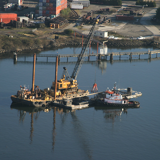
  • Examining where ships, barges, tugboats and other river activities might disturb the sediment at the bottom of the river
  • Documenting structures such as piers and piling in the river that may affect the cleanup design
  • Identifying strategies for the cleanup design

Learn More

View the completed Pre-design Studies in our Project Library

Photo of five people conducting Fish and Crab Sampling on a boat. The people are wearing blue gloves and examining fish in bins.
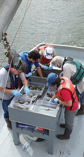
Fish and crab sampling

Activated Carbon Pilot Study

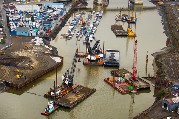
One technology that will be used in the cleanup is Enhanced Natural Recovery (ENR). ENR is used to speed up the recovery process that happens naturally as new sediment flows in from upstream. ENR involves placing a thin layer of clean sand on top of contaminated sediment to immediately lower contaminant concentrations to below harmful levels. The members of LDWG designed a study to see if we can enhance that process even more.

We wanted to see if adding activated carbon, a common material used in household water filters, would make contamination in the sediment less bioavailable* to bottom-dwelling creatures. Activated carbon binds up contaminants like polychlorinated biphenyls (PCBs), a contaminant in the Lower Duwamish Waterway, making them less accessible to bottom dwellers. PCBs are toxic to aquatic life and persist in the environment for long periods of time. PCBs can accumulate in fish creating health hazards for people and wildlife that eat the fish.

*Bioavailability is the ability for contamination to enter the food chain.

We tested adding activated carbon to the enhanced natural recovery material in three different parts of the waterway. In late 2016 and early 2017 we placed activated carbon mixed with clean sand over contaminated sediments in designated plots. Next to these test plots, we had comparison test plots where we only placed the clean sand.

To read more about the study and results, see this EPA fact sheet: Summary of Study for Lower Duwamish Waterway: Enhanced Natural Recovery and Activated Carbon.

Scientists monitored the plots each year from 2018 to 2020 to answer these questions:

  • How much activated carbon stays in place in different river conditions? With few exceptions, monitoring data shows that both the Enhanced Natural Recovery and Enhanced Natural Recovery + Activated Carbon materials generally stayed in place over the 3-year monitoring period.
  • Did activated carbon increase the benefits of Enhanced Natural Recovery material? Overall, the results indicate that both Enhanced Natural Recovery (sand only) and Enhanced Natural Recovery + Activated Carbon (sand with activated carbon mixed in) were successful in reducing the ability for PCBs to enter the food chain. This was true under a wide variety of conditions in the LDW over the monitoring period. However, Enhanced Natural Recovery reduced PCB bioavailability to the point that improvements gained by adding Activated Carbon were inconsequential.
  • How did activated carbon affects animals that live in the sediment? We found using both laboratory and field studies that the type and amount of activated carbon applied in this project is not harmful to aquatic animals that live in the sediment.

Conclusion
Based on this pilot study, EPA and Ecology have decided that while there is no harm, there is also no clear benefit in adding activated carbon to Enhanced Natural Recovery in the Lower Duwamish Waterway.

Learn More

View the Activated Carbon Pilot Study
Design Report
Year 3 Report
EPA fact sheet: Summary of Study for Lower Duwamish Waterway: Enhanced Natural Recovery and Activated Carbon

What We’ve Accomplished: Early Action Cleanups

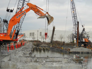
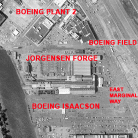
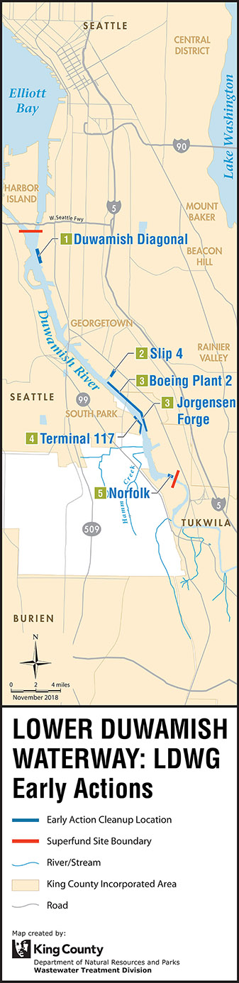
The Remedial Investigation also identified some of the most contaminated areas within the LDW where early cleanup could be started. The members of LDWG completed five “early action” cleanups to reduce the risk of exposure to contaminated sediment and get a head start on the Lower Duwamish Superfund cleanup. These early action areas were some of the most contaminated sediment areas of the LDW with the greatest opportunities for reducing polychlorinated biphenyl (PCB) contamination in the sediment. In total, these early efforts cleaned up about 29 acres of sediment and reduced average surface sediment levels of PCB contamination by over one-half, a significant step forward in the cleanup of the Lower Duwamish.

Early Action Locations

Aerial photo of a yellow excavator crane mounted on a barge near the Duwamish Diagonal. A white tugboat is supporting. In the background is the shoreline with industry and shipping containers. Photo: Ned Ahrens, King County

Duwamish Diagonal: Former Diagonal Avenue Treatment Plant

This page may be viewed in: English

The Duwamish Diagonal Site is located on the river’s east bank, a half mile south of Harbor Island. It was identified as a priority cleanup area by the Elliott Bay/Duwamish Restoration Program (EBDRP) because of sediment contamination associated with several City of Seattle and King County combined sewer overflows (CSOs) and for being home to the largest storm drain in Seattle.

It was later expanded to include the neighboring area in front of a former sewage treatment plant outfall. Between 2003 and 2004, King County implemented a cleanup on behalf of EBDRP, restoring seven acres of habitat for salmon and other species by removing contaminated sediment (the equivalent of 660 railcars) and adding clean sand.

Aerial photo Slip 4 cleanup location, looking northeast. Two barges are docked for loading or offloading of shipping containers. Photo: Ned Ahrens, King County

Slip 4: Navigational slip with industrial uses and stormwater discharges

This page may be viewed in: English

Located about three miles upstream from Harbor Island, near the Georgetown community, Slip 4 is a 6.4-acre navigational slip on the east side of the river. For many years, nearby industries used Slip 4 as a berthing area for vessels and for various industrial activities. Storm drains and emergency sewer overflows were also historically routed into the water. The slip was full of debris such as logs, pilings, bulkheads and other derelict material. As a result, about 3.5 acres of the slip’s sediments were contaminated with PCBs, metals, organic compounds, and petroleum products. The City of Seattle worked with The Boeing Company and King County to control sources of pollution to Slip 4 and clean up the area. They removed the equivalent of 98 railcars of sediment, backfilled with clean material, and restored wildlife and fish habitat.

Photo of Slip 4 cleanup construction, which shows an orange excavator on land, with arm extended over waterway. In the distance is a crane on the shoreline.
Slip 4 cleanup construction

The first step in cleaning Slip 4 was to control the ongoing pollution sources. The Washington State Department of Ecology (Ecology) and EPA led actions to control pollution at several upland sites near the slip, and ongoing efforts will ensure that Slip 4 is not re-contaminated.

With the source control complete and continued monitoring in place, the City of Seattle and King County partnered to purchase the cleanup area within the slip and convert it to wildlife and fish habitat. This sediment cleanup and removal project took place between October 2011 and February 2012 and was completed ahead of schedule and under budget.

Black and White historical photo of Boeing Plant 2. Photo shows more than a dozen aircraft lined up at airport facility.

Boeing Plant 2: World War II-era aircraft manufacturing plant

This page may be viewed in: English

Boeing Plant 2 is located near South Park on the east side of the Lower Duwamish Waterway. At this early action area, Boeing remediated 18.3 acres, the equivalent volume of 1,650 railcars, of sediment contaminated with PCBs from this site and restored nearly one mile of fish and wildlife habitat. 170,000 native plants and large woody debris were installed along the water’s edge to create ideal habitat for juvenile salmon as they migrate downstream.

Boeing built Plant 2 along the Lower Duwamish Waterway in the late 1930s to manufacture military aircraft for the U.S. Government, turning out over 7,000 B-17 bombers during World War II. Hazardous chemicals were found in the soil, sediment, and groundwater surrounding the area, which were cleaned up starting in 2010 when the manufacturing buildings were demolished. Boeing completed a final cleanup of sediment and created the shoreline habitat in 2015.

Aerial photo of Terminal 117. Photo shows the Duwamish Waterway and on the shoreline is a marina and street grid with business and industry.

Terminal 117: Once an asphalt shingle manufacturing facility

This page may be viewed in: English

Terminal 117 is a former asphalt shingle manufacturing facility located in Seattle’s South Park neighborhood on the river’s west bank. Soils at the site were contaminated with PCBs. From 2012 to 2015, the Port of Seattle and City of Seattle remediated 1.4 acres of sediment from the bank and mudflat, the equivalent volume of more than 140 railcars. Contaminated soil was also removed from the former facility property, adjacent residential yards, parking strips, alleys, and streets.

From 1937 to 1993, Duwamish Manufacturing Company and Malarkey Asphalt Company used the Terminal 117 site to industrially manufacture asphalt shingles, using contaminated waste oil as fuel. The asphalt shingle manufacturing operations left waste oil in the upland soils and river sediment. This produced dangerous levels of pollutants in soils and sediment that primarily contributed to unsafe PCB levels in the Lower Duwamish Waterway. In 1999, the Port of Seattle acquired the site and Superfund cleanup to remove PCB-contaminated soil began. The Port of Seattle and City of Seattle completed the cleanup in 2015.

Aerial photo of the Duwamish Shoreline Plant 2 Construction. This photo shows seven barges on the waterway, with mounted cranes and excavators. Along the shoreline is a marina and in the distance is the South Park Bridge.
Barges during Terminal 117 cleanup
Black and white aerial photo of the Jorgensen Forge area. The photo includes labels in red for Boeing Plant 2, Boeing Field, Jorgensen Forge, Boeing Isaacson and East Marginal Way.

Jorgensen Forge: Heavy industrial use since the 1940s

This page may be viewed in: English

The Jorgensen Forge facility is a steel and aluminum forging and distribution facility located south (upstream) of Boeing Plant 2. The area is contaminated with metals and PCBs. Originally developed in 1942 by the Navy to produce naval equipment, the property has had several owners over 80 years. The Jorgensen Forge Corporation conducted some initial cleanups of the area under orders from Ecology. This cleanup is still ongoing.

Contamination at this site is the result of heavy industrial use since the 1940s and contaminated groundwater that has migrated onto the property from off-site sources. The upland property, groundwater beneath the property, banks and sediments adjacent to the Jorgensen Forge facility contain metals and PCBs. In 2014,  1.6 acres of the bank and sediments were removed. However, samples collected after the excavation found that some sediments were still contaminated and may need additional cleanup actions.

Aerial Photo of the Norfolk CSO area. Image shows multiple parking lots near the waterway area and the shoreline lines with a few trees. Photo: Ned Ahrens, King County

Norfolk: Several CSOs and stormwater discharges

This page may be viewed in: English

The Norfolk CSO, or combined sewer overflow, is located next to the Boeing Developmental Center, upstream of the Duwamish River Turning Basin. Norfolk CSO shares an outfall with the Norfolk storm drain, an 826-acre drainage basin that drains residential, commercial, and some industrial areas in south Seattle to the south and west of the King County International Airport. The submerged sediments around the CSO were found to contain high levels of certain contaminants, mainly mercury, bis (2-ethylhexyl) phthalate, and PCBs.

In 1999, King County remediated 1 acre, the equivalent of 52 railcars, of contaminated sediment and backfilled the area with clean material. The Boeing Company also remediated a small area, removing the equivalent of 1 railcar of contaminated sediment from an area offshore of a storm drain outfall, and then filled that area with clean sand to reduce the potential for PCB recontamination of the Norfolk CSO/storm drain cleanup area.

The Norfolk CSO is now controlled. A “controlled” CSO can overflow no more than one time each year, based on a long-term average. This limit is set by Ecology and King County’s own policies. Before it was controlled, the Norfolk CSO discharged run-off and untreated sewage during periods of heavy rainfall when the sewer system was inundated with water.

Illustrative map showing the Lower Duwamish Waterway superfund site. This map identifies the LDWG early actions: Slip 4, Boeing Plant 2, Jorgensen Forge, Terminal 117, Norfolk, and Duwamish Diagonal. It also identifies the southern and northern boundaries of the Superfund Site.